Are you looking for some easy hikes in Grande Cache that you can do with the family? Well, you are in luck. Grande Cache, Alberta is known mostly for the Death Race and long, often steep, back-country hikes. However, there are a few shorter hikes (mainly to waterfalls) that are great for families. And being only about an hour and a half drive from Grande Prairie, it makes for a great day trip from the northern city. So grab the kids and check out the wild, rugged, scenery of Grande Cache. Similar to Jasper with beautiful mountains, and jewel-hued rivers except without the crowds.
While Grande Cache has many amazing hikes, I find the majority are classified as 'hard' or are just too long for the kiddos. These 5 easy, family-friendly Grande Cache hikes should be do-able with kids of all ages. Generally, these trails can be done within 10 minutes to 3 hours.
*This post may contain affiliate links in which I would earn a small commission at no extra cost to you. Read my full disclosure here.
Note: I have put these hikes in order from closest to GP (Grande Prairie) to furthest except for Torrens River Falls (which is actually the closest).
**Also, beware of bears and other wild animals. Carry Bear Spray as there are many around Grande Cache!
Twin Falls Hike, Grande Cache

The bumpy road to the Twin Falls trail

Hells Creek from beside Twin Falls

Twin Falls Trail - easy with some tree roots

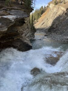
Beautiful Twin falls from the bottom lookout
Directions: 11.5 kms North of Grande Cache on Highway 40. A sign is posted and visible from the highway (although not until you have passed by...so put it into google maps!).
Interested in a map with all hiking trails and directions? Try the AllTrails App
Length: 3.2 km roundtrip if you park beside highway 40, otherwise closer to 1.5 km if you drive up the rocky little road and park close to the trailhead.
Difficulty: Easy, with a more difficult scramble at the end if you want to go up to the top.
We took our 4 kids on this easy hiking trail last summer and all loved it! The little road off highway 40 was rocky but quite dry. Taking it slow, we were able to drive up to the open area by the trailhead with our expedition. From there, an easy trail meanders through the trees alongside Hell's Creek.
Upon reaching the two sets of falls, there is a great viewpoint from the bottom. Afterward, a rather steep scramble to get to the top of the first set of falls. Part of this steep part does have a rope- although it appeared to not be in the best condition when we were there. Having my 3 year old strapped on me in a carrier, I was slipping too much to get to the top!
Others have commented that you can get behind the 1st set of waterfalls and even go up a trail to the top of the 2nd falls. We didn't make it that far, but please let me know in the comments if you do!
Be aware that some of the banks beside the creek are unstable. The trail may also be muddy in the spring.
Sulphur Gates - Easy Trails & Viewpoints

One of the several viewpoints

Another viewpoint

Mossy rocks

The short mossy trail through the trees back to the parking lot
Directions: 5 km North of Grande Cache on Hwy 40, turn left directly after the Smoky River Bridge at the sign for "Wilmore Wilderness Park- Sulphur Gates". Follow in until you reach the parking lot (about 8 km).
Length: 0.6 Km to visit all viewpoints
Difficulty: Fairly Easy. Graveled pathways with some stairs and short steep sections.
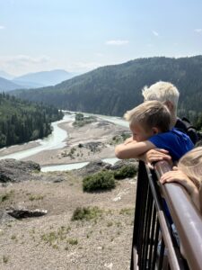
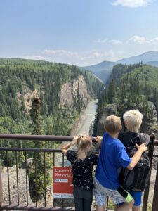
The Sulphur Gates has great cliff viewpoints of the merging of the Smoky and Sulphur Rivers. Having mostly wide, graveled paths, this is a beautiful area and all viewpoints can be seen in 10 minutes. It should not be missed! Containing a large parking lot, campsites (equestrian sites and regular sites down the road), outhouses, and picnic tables makes the place a good spot for a picnic. And don't forget to visit the Crack of Doom!
If you're looking for another view from across the river (and a longer hike) check out the Sulphur Gates South Side Trail. I haven't hiked it, but others say it is a moderate hike (with the exception of the last km or so which is steep with some loose rock) and around 8.9 km long.
Eaton Falls

The main trail to Eaton Falls

The smaller trail off the main trail to get to the falls

The creek below the falls

Bottom half of Eaton Falls

Eaton Falls

Creek crossing
Directions: 5 km North of Grande Cache on Hwy 40, turn left directly after the Smoky River Bridge at the sign for "Wilmore Wilderness Park- Sulphur Gates". Follow in until you reach the parking lot (about 8 km). (Yes, the trailhead starts beside the trail to the Sulphur Gates viewpoints!)
Length: 7.1 Km roundtrip
Difficulty: Moderate.
The Eaton Falls hike is a great one to pair with a visit to the Sulphur Gates with your family, as they both start from the same parking lot. To begin, the trail appears like a wide, rocky road going uphill forever. Once you get past this first rocky incline, then the path is quite easy. Eventually (about 2 kms up the trail), there is a path on the right that stems off the main trail with an arrow and sign stating "Eaton Falls". Take this narrow path through the coniferous forest to reach the waterfall.
I absolutely loved Eaton Falls...it is my favorite of the waterfalls I have visited in Grande Cache! The moss covered rocks and gorgeous falls are tucked away in the trees making it feel so mystical. Likewise, the kids thoroughly enjoyed playing around the shallow river in the forest oasis.
Muskeg Falls Hike by Grande Cache

Upriver of Muskeg Falls

Muskeg Falls

Downriver
Directions: 16 kms South of Grande Cache on Hwy 40. There is a pull-out, however the trail was not marked when I went.
Length: 1.6 Km roundtrip
Difficulty: Moderate
Use google maps so you don't miss the trail as it was not marked when we went! Muskeg Falls is a short and fairly easy hike - good for the whole family. Close to the trail end is a short decent that was rather steep close to where the trail goes down to the falls. However, there are tree roots for grip! According to reviews, there is supposed to be a "Y" in the trail and a left trail to go down to the bottom of the falls but we couldn't find it. It appeared that some of the cliffs had fallen away so maybe that took out this secondary trail.
Be careful around the edges! Sometimes the ground was only a shelf, waiting to fall at anytime!
Torrens River Falls/ Torrens Chutes
Directions From Grande Prairie: Go South on hwy 40, then take hwy 666 through Grovedale. Turn right at the stop sign and continue past the pavement on gravel until Km 145. At the hairpin turn at the bottom of the hill, you will see a road going straight through some trees. Head through until it opens up, then park at the trailhead.
Directions from Grande Cache: Go North on hwy 40 for 120 kms, turn left onto Weyerhauser North Road, after 9.4 km merge onto Main Haul Rd/Weyerhauser Rd, after 20.7 kms turn left onto Two Lakes Cut Across Rd, go 34.8 kms then turn left onto Two Lakes Rd for 90.1 kms. At the hairpin turn at the bottom of the hill, you will see a road going straight through some trees. Head in until it opens up and park at the trailhead.
Length: 5.3 Km roundtrip
Difficulty: Moderate
This trail I found with some digging on the AllTrails website. I had never heard of it before! The pictures remind me of Red Willow Falls with the flat, slate, rock making up the river bed and falls. From what I read, it is a fairly easy trail following the river for most of it with some steeper sections.
Located about 2 hours drive from Grande Prairie, and about 3.5 hours drive from Grande Cache. Even though on a map it appears in the middle of the two places, it is accessed from a road close to Grande Prairie.
Bonus: Other Family Activities & Hikes in Grande Cache

Rotary Park playground
Not done hiking yet?! There are several trails around and in the town of Grande Cache. Also, the kids may enjoy the Grande Cache Labyrinth (there is a trail from Labyrinth Park to Victor Lake as well) and the Rotary playground. The swimming pool at the rec center is also fantastic. Try out the Ridge View Restaurant or a good latte or ice cream for the kids across the street.
I hope you found this list of 5 easy, family-friendly hikes in Grande Cache useful! Please let me know in the comments below if there are any I missed! Have you done any of these hikes? What did you think? Do you have any info you think I should add? Thanks for the help and thanks for reading!
Take care,

